Flood Zones in Clinton, Greene and Highland Counties: What Buyers and Sellers Need to Know
Flood risk in Clinton County, Greene County, and Highland County follows the creeks, not the county lines, and it is parcel-specific. FEMA's 100-year flood zones sit along Todd's Fork, Cowan Creek, Dutch Creek, and Lee's Creek in Clinton County, along the Little Miami River and Massies Creek in Greene County, and along Paint Creek and the Rocky Fork in Highland County. Only about 1 in 218 Ohio households carries flood insurance, yet a federally backed mortgage makes it mandatory in a 100-year zone. Here is how to check any address, what the zone letters mean, and what a flood designation costs.
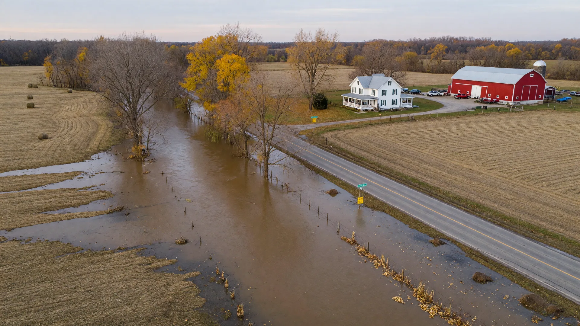
The same creek that floods the low ground can leave the house, sitting on higher ground, well outside the mapped zone. Parcel by parcel is the only accurate way to read it.
Flood zones do not show up in the same way a well or a furnace does on a tour. You cannot see a FEMA zone from the street, and a dry summer gives no hint of where water spreads in a heavy rain. But the maps exist, the rules are federal and state law, and both buyers and sellers in the three counties run into them at the closing table. This guide covers which waterways carry the mapped risk, how to read the zone letters, what the 2025 Clinton County map update means, what Ohio requires sellers to disclose, what flood insurance costs, and the exact steps to check one address.
Each county's story is a little different. Clinton County is the site of FEMA's newest map work, Greene County carries the Little Miami and Massies Creek corridors, and Highland County centers on Paint Creek and the Rocky Fork. The common thread: the floodplain sits on the flat, low ground beside the water, and much of the rural land in all three counties is exactly that kind of ground.
Table 1. Main mapped flood sources in Clinton, Greene and Highland counties and the status of each county's FEMA maps (verify any single parcel with FEMA's Flood Map Service Center)
| County | Mapped flood sources | Where the 100-year zones sit | Map status |
|---|---|---|---|
| Clinton County | Todd's Fork, East Fork Todd's Fork, Cowan Creek, Dutch Creek, Anderson's Fork, Caesar Creek, Rattlesnake Creek, Lee's Creek | Creek and tributary corridors around Wilmington and the rural townships, especially the Todd's Fork drainage east of the city | Preliminary update released July 24, 2025; 90-day appeal period began about July 30, 2025 |
| Greene County | Little Miami River, Massies Creek, Caesar's Creek, Mad River, Shawnee Creek | River corridors through Xenia, Spring Valley, and the rural townships where the creeks meet the Little Miami | Little Miami watershed maps effective March 8, 2022; FIRMs current through FEMA's Map Service Center |
| Highland County | Paint Creek, Rocky Fork, tributaries around Rocky Fork Lake | Paint Creek valley and the low ground around Rocky Fork and its lake outlets | County FIRMs and flood studies available through FEMA's Map Service Center |
These are the mapped flood sources named in the FEMA flood map review for Clinton County, the Greene County Hazard Mitigation Plan, and the Clinton County Emergency Management Agency. A creek being listed here does not mean every property near it is in a flood zone; it means the county has mapped floodplain along that waterway, and individual parcels must be checked one at a time.
Is Wilmington, Ohio, in a flood zone?
Most of the city of Wilmington proper sits on higher ground, and the mapped floodplain in Clinton County follows Todd's Fork and its tributaries, which run east of the city and through the rural townships rather than across the downtown core. The city drains toward the Todd's Fork subwatershed of the Little Miami, but draining toward a creek and sitting inside its mapped 100-year zone are two different things.
The honest answer for any specific address is: look it up. A property on a higher bluff, a subdivision street, or a downtown block can be in low-risk Zone X while a farmhouse a mile away, in the creek bottom, sits inside the 100-year zone. The boundary is drawn on the FEMA map parcel by parcel, and it does not follow neighborhood lines, price ranges, or anything you can see from the road.
What does the 2025 Clinton County flood map update mean?
On July 24, 2025, FEMA released updated preliminary Flood Insurance Rate Maps for Clinton County and its incorporated areas for public review, with a 90-day appeal period that began around July 30, 2025. "Preliminary" is the key word: the new maps are not in effect yet. FEMA resolves the appeals and any map changes, then issues a final determination before the maps become effective, which is typically months later.
What this means in practice: a property can move into, or out of, a mapped flood zone when the new maps take effect, so the zone that applied to an address last year may not be the zone that applies at closing. Anyone buying, selling, or refinancing in Clinton County should ask which maps govern the transaction and re-check the parcel on FEMA's Flood Map Service Center after the final determination is published. Clinton County participates in the National Flood Insurance Program, which is what makes NFIP flood insurance available for properties in the county at all.
What do the flood zone letters on a FEMA map mean?
Every parcel in the three counties falls into one of a handful of FEMA zone categories. The letters tell you the risk level, and the risk level drives both the lender's insurance requirement and the premium. The Ohio Department of Natural Resources and FEMA publish the official definitions of each zone.
Table 2. FEMA flood zone letters used on Clinton, Greene and Highland county maps and what each means for a property
| Zone | Risk level | Annual flood chance | What it means for buyers |
|---|---|---|---|
| AE | High (Special Flood Hazard Area) | 1% (the "100-year" flood) | Mapped flood depth and a Base Flood Elevation are published; flood insurance is mandatory for a federally backed mortgage |
| A | High (Special Flood Hazard Area) | 1% (the "100-year" flood) | Mapped by approximate methods with no Base Flood Elevation shown; same insurance requirement as AE |
| X (shaded) | Moderate | 0.2% (the "500-year" flood) | Inside the 500-year floodplain; insurance is optional but often recommended by agents and lenders |
| X (unshaded) | Low | Outside mapped floodplains | No mapped floodplain on the current maps; insurance is optional |
A "100-year" flood is a 1% chance in any single year, which works out to about a 26% chance over a 30-year mortgage. It is a statistical probability, not a promise that a property floods once a century. That is the single most useful number to keep in mind when you compare an AE lot to an X lot: the same parcel can carry real flood risk and a real insurance premium that has nothing to do with how dry it is on a sunny Saturday.
Do I need flood insurance on a home near Wilmington?
If the building sits in a FEMA Special Flood Hazard Area (a zone beginning with A or V) and secures a federally backed or federally regulated mortgage, flood insurance is mandatory under the Flood Disaster Protection Act of 1973, implemented through 12 CFR Part 339. That covers most conventional, FHA, VA, and USDA loans. The requirement is federal and attaches to the loan, so it applies in every county and regardless of whether the property has ever actually flooded.
A cash buyer is not bound by that federal mandate, but the flood risk and the annual premium still belong to the property, so the numbers below are worth budgeting either way. An elevation certificate, prepared by a licensed surveyor or engineer, records the building's lowest floor height relative to the Base Flood Elevation; it does not waive the insurance requirement, but it can lower the premium for a building raised above the flood line. FloodSmart's elevation certificate guide explains who prepares one and when it is needed.
Table 3. Typical 2025-2026 flood insurance premiums in Ohio by FEMA zone, from published analyses of National Flood Insurance Program policy data (planning figures, not quotes for your property)
| Coverage situation | Typical annual premium | Notes |
|---|---|---|
| Ohio average, all policies | About $883 to $1,109 | Published figures vary by dataset year (FEMA 2023 data vs 2025-26 policy data) |
| Zone AE | About $1,260 | High-risk zone with a published Base Flood Elevation |
| Zone A | About $1,052 | High-risk zone mapped by approximate methods |
| Zone X | About $753 | Moderate-to-low risk; insurance optional |
| National average, all policies | About $888 to $955 | Ohio sits near the national average |
Two context numbers make the table sharper. Only about 1 in 218 Ohio households carries an NFIP policy, per the State of Ohio Enhanced Hazard Mitigation Plan, even though all 88 Ohio counties have some mapped flood risk. And Ohio has roughly 750 participating NFIP communities, which is what makes NFIP coverage available in Clinton, Greene, and Highland counties at all. Exact premiums depend on your property's elevation, coverage amount, and deductible, so the table is a planning range, not a quote. A licensed insurance agent who writes NFIP policies can price your specific address.
What must sellers disclose about flooding in Ohio?
Ohio law is specific about this. Under Ohio Revised Code Section 5302.30, sellers complete the state's Residential Property Disclosure Form before closing. Section J asks whether the property is located in a designated flood plain (with Yes, No, or Unknown as the lawful answers), and Section K asks whether the seller knows of any past or current flooding, drainage, settling, grading, or erosion problems, including repairs made in the past five years.
The key limitation: sellers only have to disclose what they actually know. Answering "Unknown" is a lawful answer on the form. That is not a red flag on its own, but it means the buyer cannot rely on the form as the only source of truth. The accurate flood status for an address lives on the FEMA maps and in the county records, and it costs nothing to check.
How do I check the flood zone for a specific address?
Step 1: Look the address up on FEMA's Flood Map Service Center
Enter the address at msc.fema.gov and pull the FIRMette for the parcel. The map shows the zone letter and whether the building falls inside the Special Flood Hazard Area. FEMA's guide for real estate and lending professionals walks through reading the map.
Step 2: Cross-check on the county's own parcel map
Each county maintains a GIS parcel map where you can view the property and its surrounding floodplain. Use the Clinton County Auditor GIS map at clintoncountyauditors.org/gis-map, the Greene County Auditor viewer at gis.greenecountyohio.gov, or the Highland County Auditor and the Highland County GIS office for Highland County parcels.
Step 3: Let the lender's flood determination confirm it
On a financed purchase, the lender orders a flood determination from a vendor, and the resulting letter states the zone for the parcel. The determination can differ from a homeowner's quick map check when FEMA is mid-update, so the official letter is the document the closing relies on. It is worth asking which FEMA map version the determination is based on, especially in Clinton County while the 2025 update is pending.
From our office: how we handle a listing that touches a flood zone
When a property we are marketing, or one a buyer wants to see, shows up near a mapped waterway, our process is the same every time: pull the FEMA map for the parcel, read the whole parcel and not just the foundation, review the seller's disclosure answers, and order a flood determination the moment financing is involved. We do not interpret the maps as a recommendation for or against a property, because floodplain status is data, not a verdict. What we do is make sure the zone, the premium range, and the disclosure are on paper before an offer is written, because the two things that most often surprise people are the lender's insurance condition showing up at closing and an annual premium they never budgeted.
That routine is part of how we run every buyer and seller transaction in the three counties, and it pairs with the same due diligence mindset covered in our wells and septic buyer's guide for rural acreage.
What does a floodplain designation mean for a rural property with a well and septic?
Floodplains are, almost by definition, the flattest, lowest ground around, and that is also the ground rural septic drain fields and well access routes often get built on. The county health districts evaluate stream setbacks as part of every septic site evaluation, so a proposed or existing drain field's position relative to a waterway is a reviewed item, not a guess. A flood zone on the lot does not make a rural property un-buyable; it makes the location of the well, the septic field, and any outbuilding part of the due diligence, the same way the systems themselves are.
For the full picture on private water and wastewater in the three counties, our wells and septic guide covers testing, point-of-sale rules, and costs, and the winter maintenance guide covers how the same systems behave through a southwest Ohio freeze. For what acreage actually sells for, the Country and Acreage guide is the place to start.
The buyer's flood-zone checklist for the three counties
1. Run the address check before you fall in love
Ten minutes on FEMA's Map Service Center and the county GIS viewer tells you the zone before a single tour, so a floodplain designation never surprises you at the offer stage.
2. Read the whole parcel, not just the house pad
The zone boundary often crosses the lot. Check where the house, the outbuildings, and any septic drain field sit relative to the flood line, because a dry foundation can share a parcel with a mapped creek bottom.
3. Ask the seller about the disclosure form
Request the Residential Property Disclosure Form early and read Sections J and K for the flood plain answer and any known flooding or drainage issues. Then verify independently, because "Unknown" is a lawful answer.
4. Budget the premium into the monthly number
On an AE or A lot, the premium range in Table 3 is a real monthly line item that belongs in any apples-to-apples comparison with a Zone X property. The cost-of-living page shows where these recurring costs sit against the rest of a Clinton County budget.
5. Know the map version at closing
With Clinton County's 2025 preliminary maps still working through the process, ask your lender which map the flood determination is based on and whether the new maps could change the zone before you close.
What should sellers do if their property touches a flood zone?
Sellers, the documents that de-risk a flood-adjacent sale are the same ones a buyer should ask for. Have a copy of the disclosure form with your answers, a printed FIRMette for the parcel, and any elevation certificate from a prior transaction. Answer the flood plain question truthfully, including "Unknown" if you genuinely do not know, because a false answer creates liability the maps never will. If a buyer's financing lands on the mandatory insurance condition, the premium is typically their cost to carry, but knowing it is coming and sharing the zone letter up front keeps the negotiation honest.
If you are deciding what to fix before listing, the Selling Guide covers prep and pricing, and a free home valuation shows where your property stands today, floodplain or not.
Flood zone questions buyers and sellers ask us most
Is Wilmington, Ohio, in a flood zone?
Most of the city sits on higher ground, and the mapped zones follow Todd's Fork and its tributaries east of town. The answer is parcel-specific, so the only reliable way to answer for one address is to look it up on FEMA's Flood Map Service Center or the county GIS map, and to re-check when the 2025 Clinton County maps take effect.
Do I need flood insurance on a home in Clinton, Greene, or Highland County?
Only when the building is in a FEMA Special Flood Hazard Area (an A or V zone) and secures a federally backed loan. That requirement comes from federal law, not Ohio, and it applies regardless of whether the property has ever flooded. Properties outside the SFHA do not face the mandate, though coverage is available to nearly all NFIP-participating communities.
How much does flood insurance cost in Ohio?
Published analyses put the Ohio average near $883 to $1,109 a year, with zone averages around $1,260 for AE, $1,052 for A, and $753 for X. Your actual premium depends on elevation, coverage, and deductible, and an elevation certificate can reduce it for a building raised above the base flood elevation.
What must a seller disclose about flooding in Ohio?
Under Ohio Revised Code Section 5302.30, the seller answers the Residential Property Disclosure Form, including whether the property is in a designated flood plain and whether they know of any past or current flooding or drainage problems. Sellers disclose what they know, and "Unknown" is lawful, so buyers should verify the maps themselves.
Where can I check if a specific address is in a flood zone?
Use FEMA's Flood Map Service Center at msc.fema.gov, then confirm on the county parcel map: the Clinton County Auditor GIS map, the Greene County Auditor GIS viewer, or the Highland County Auditor with the Highland County GIS office. On a financed purchase, the lender's flood determination letter is the official document the closing uses.
Can part of a parcel be in a flood zone while the house is not?
Yes. Flood boundaries frequently cut across a lot, so the house can sit in low-risk Zone X while the creek-bottom portion, an outbuilding, or a septic drain field sits inside the 100-year zone. Check the whole parcel and factor the low ground into where improvements sit and what the disclosure form says.
Flood zones are one of several property facts that live in the public record, not on the tour. The Wilmington FAQ covers the neighboring questions about taxes, schools, and commute time, and the Market Report tracks Clinton County pricing and days on market so you can compare any property against the wider market.
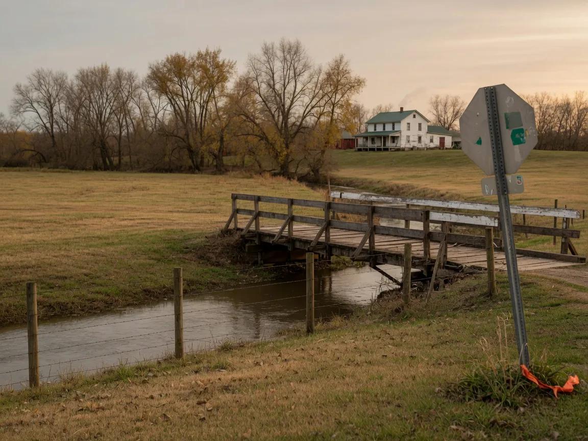
The low ground along these creeks is where the mapped floodplain sits, and it is parcel by parcel that the zone letters apply.
Authoritative sources referenced in this guide
- FEMA Flood Map Service Center (address lookup and FIRMettes)
- FEMA press release: Clinton County residents invited to review flood maps (July 24, 2025)
- FEMA: Understanding flood risk for real estate, lending, and insurance professionals
- 12 CFR Part 339: Loans in Areas Having Special Flood Hazards
- Ohio Residential Property Disclosure Form (Ohio Department of Commerce)
- State of Ohio Enhanced Hazard Mitigation Plan, Section 2.2 (Flood)
- Ohio DNR: Flood maps and studies
- Clinton County Emergency Management Agency: Floods
- Greene County 2020 Hazard Mitigation Plan
- FloodSmart: Get an Elevation Certificate
- Clinton County Auditor: GIS map
- Greene County Auditor: GIS viewer
- Highland County Auditor and Highland County GIS office
- Policygenius: NFIP flood insurance cost analysis (FEMA 2023 data)
- NerdWallet: Flood insurance cost by state
Published October 30, 2026. Scheduled for annual review each fall so map status, disclosure forms, and premium ranges stay current. Flood maps and premium figures change over time, and Clinton County's 2025 preliminary maps are still moving through FEMA's review process, so verify the current map and zone for a specific address before closing.
This article is general educational information about flood zones, flood insurance, and disclosure rules. It is not legal, tax, financial, insurance, or lending advice, and it is not a flood risk assessment for any property. Flood zone status, insurance requirements, and premiums depend on the specific address, the current FEMA maps, the lender, and the insurer. Consult qualified professionals: a licensed insurance agent who writes NFIP policies, a lender for your loan's flood determination, a licensed surveyor or engineer for an elevation certificate, a real estate attorney for disclosure questions, and the appropriate county office for parcel records.
Glasshouse Realty is committed to fair housing and does not discriminate on the basis of race, color, religion, sex, national origin, familial status, disability, or any other protected class. This guide presents flood zone data and the relevant laws so that consumers can evaluate properties objectively; it does not rate, rank, or steer toward or away from any neighborhood or community. Buyers and sellers are free to choose their own insurance agents, lenders, surveyors, inspectors, and title providers, and you are never obligated to use any provider we mention or recommend.
How we help with flood-zone due diligence
We live and work in this community, and we look at the public record the same way on every transaction: parcel maps, disclosure forms, and the lending requirements that shape a closing. When a property touches a mapped waterway, we will show you the zone, the cost, and the disclosure before you write an offer, and we will keep the map version straight through closing.
Buying or selling in Clinton, Greene, or Highland County?
Call or stop in to the Glasshouse Realty Wilmington office. We will walk you through the flood zone check and every other due diligence question for any property on your list, no pressure.